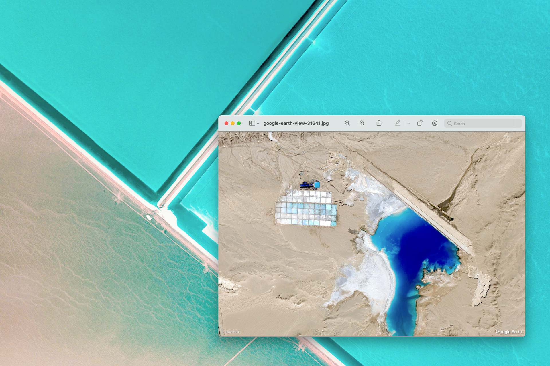
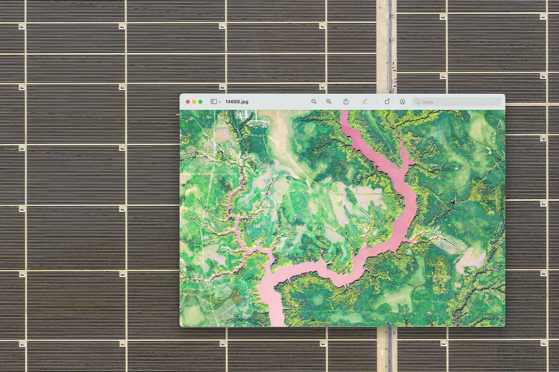
The planet's surface is detected by satellites that travel 600 kilometers high above the earth and to which it takes about two days to cover the entire earth's surface, immortalizing details up to the size of about ten centimeters.
Visualization software such as Google Earth integrates the images produced by the different satellites allowing the bird's-eye observation of the terrestrial landscape, from which an extensive anthropization of ecosystems emerges as a constant.
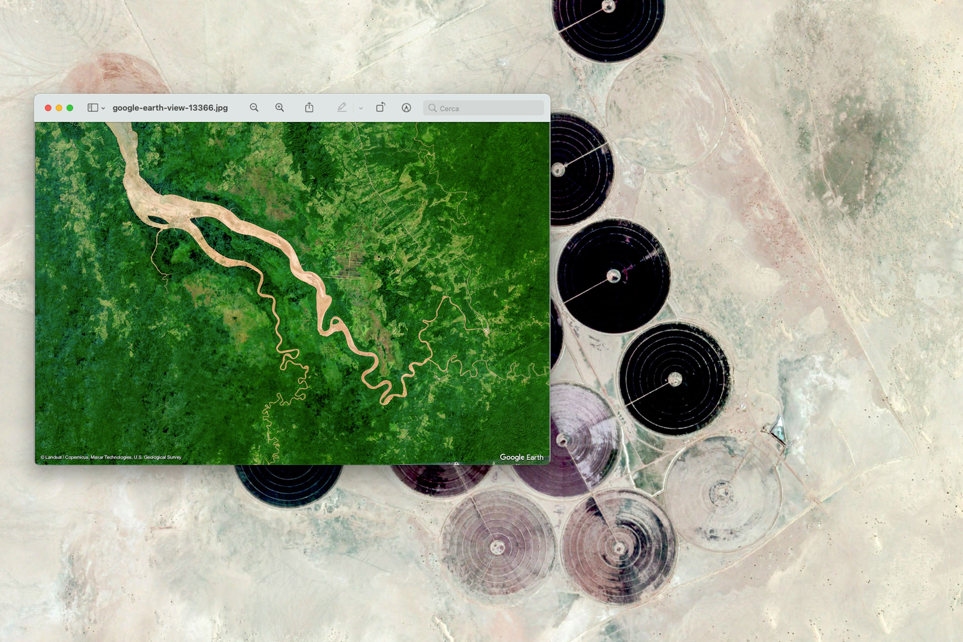
Unnatural geometries with synthetic colors, artificial borders that clearly dissect natural landscapes, rivers that disappear in huge dams and forests consumed by cultivated fields draw the anthropic landscape, mixing natural and artificial elements.
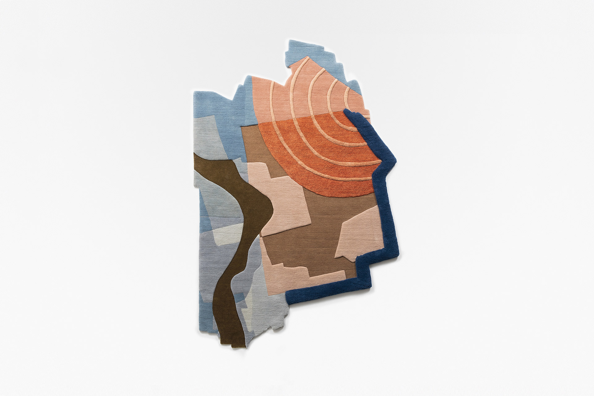
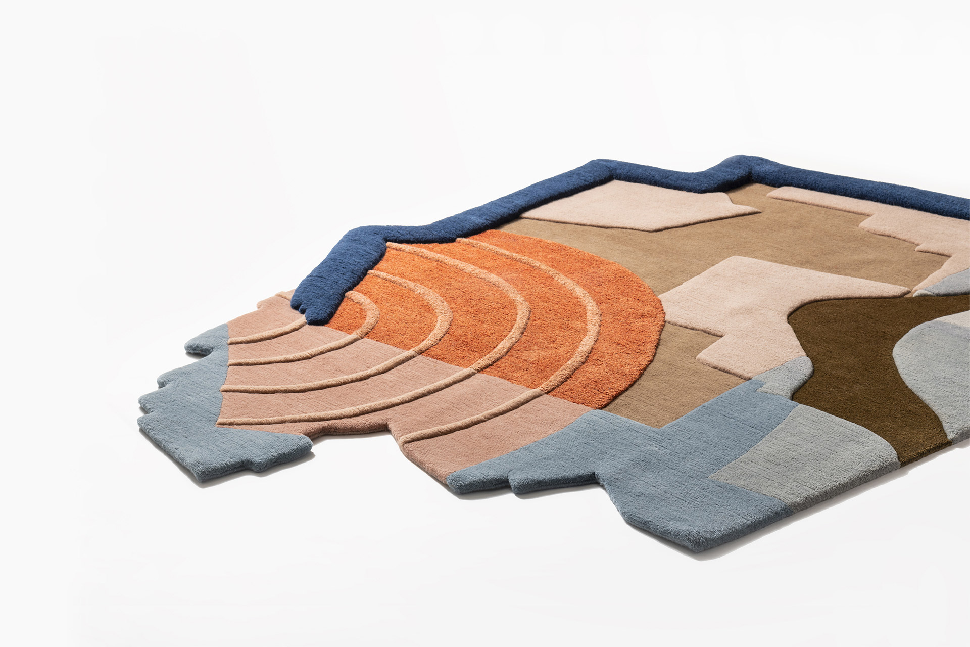
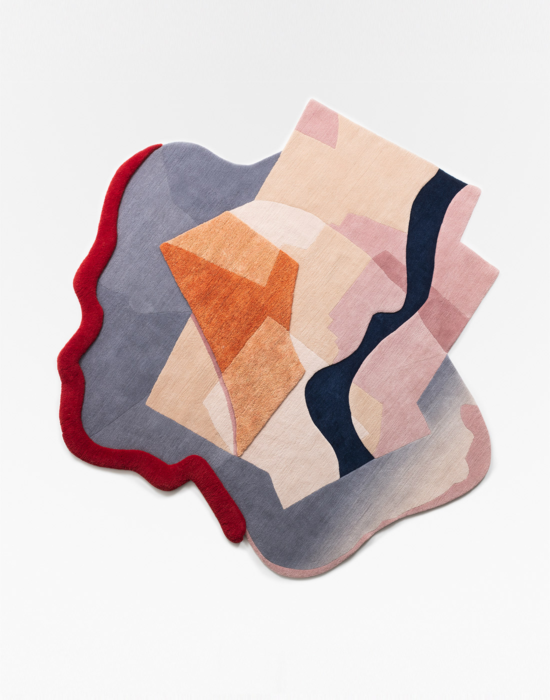
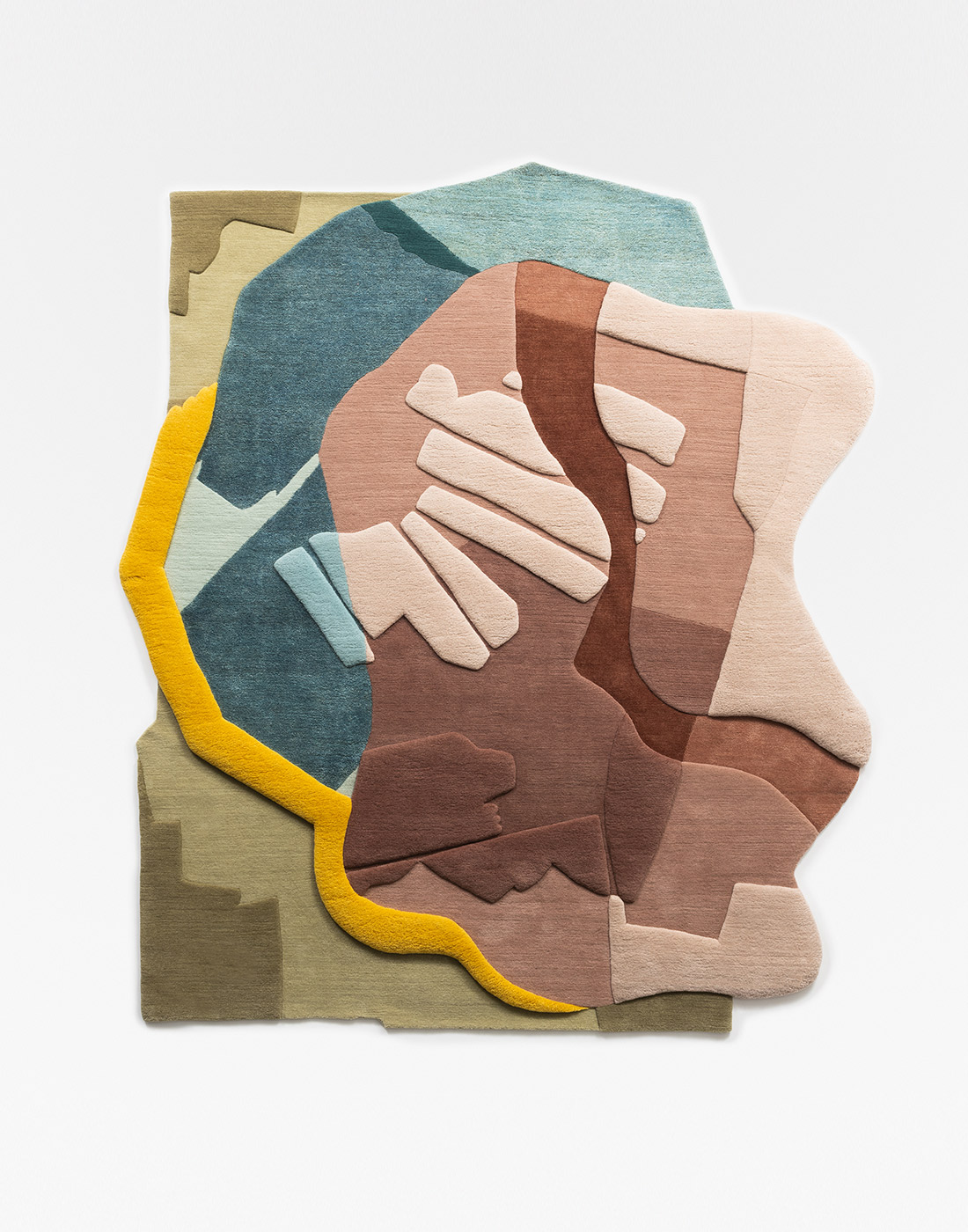
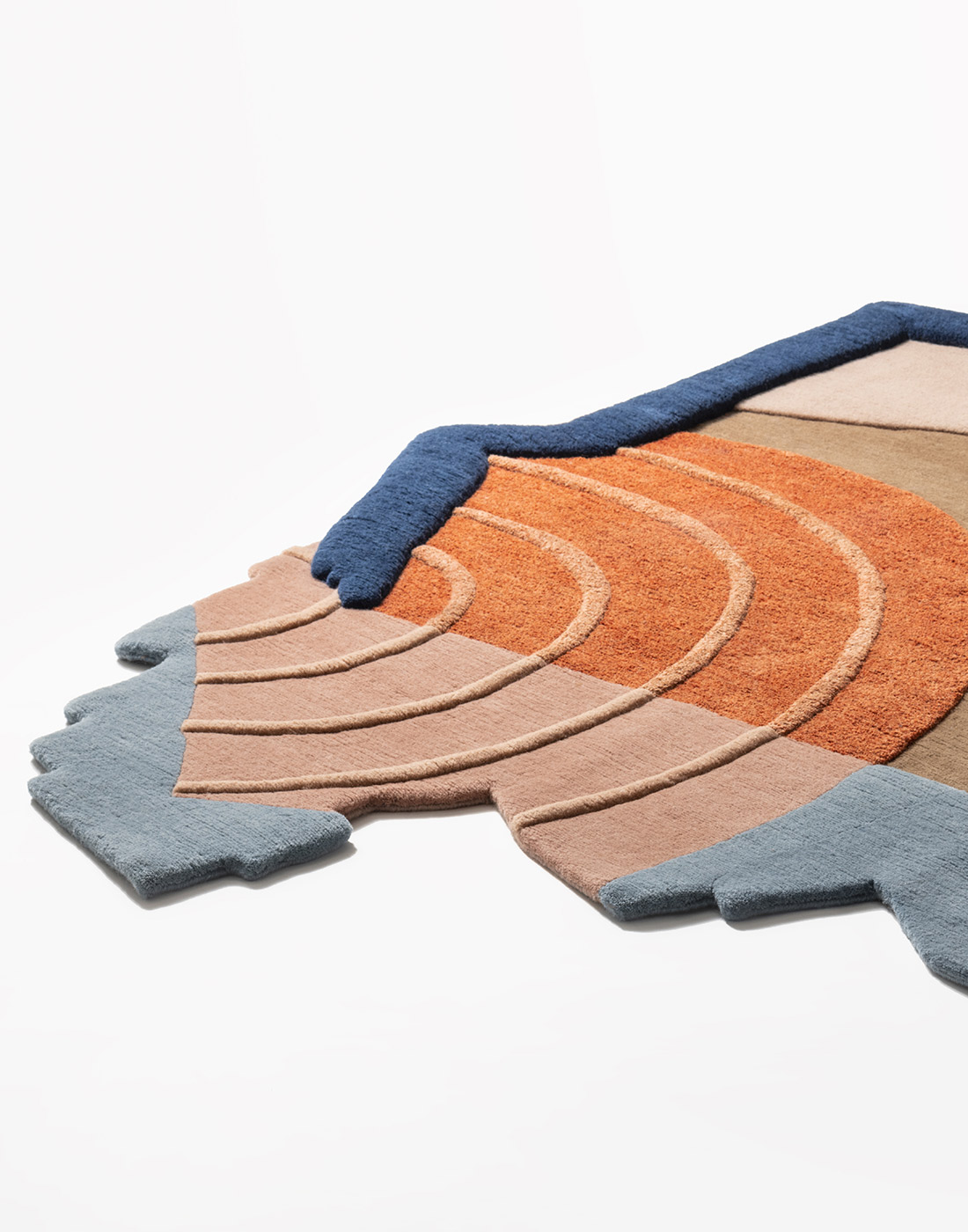
Antropico Entropico is a triptych of carpets that interprets the cartographic elements extrapolated from more than 90,000 satellite images reviewed, which are decomposed and reassembled according to an entropic principle.
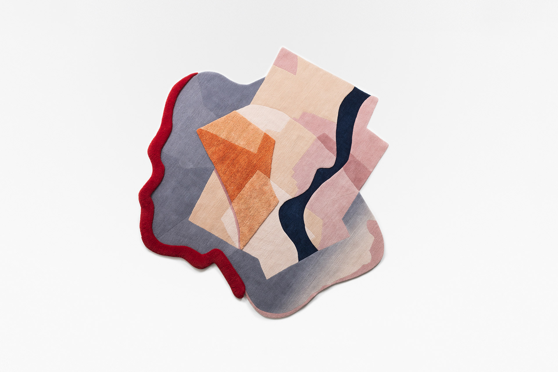
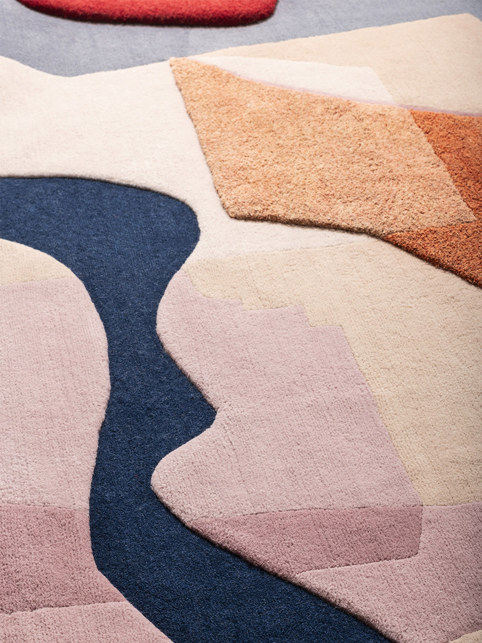
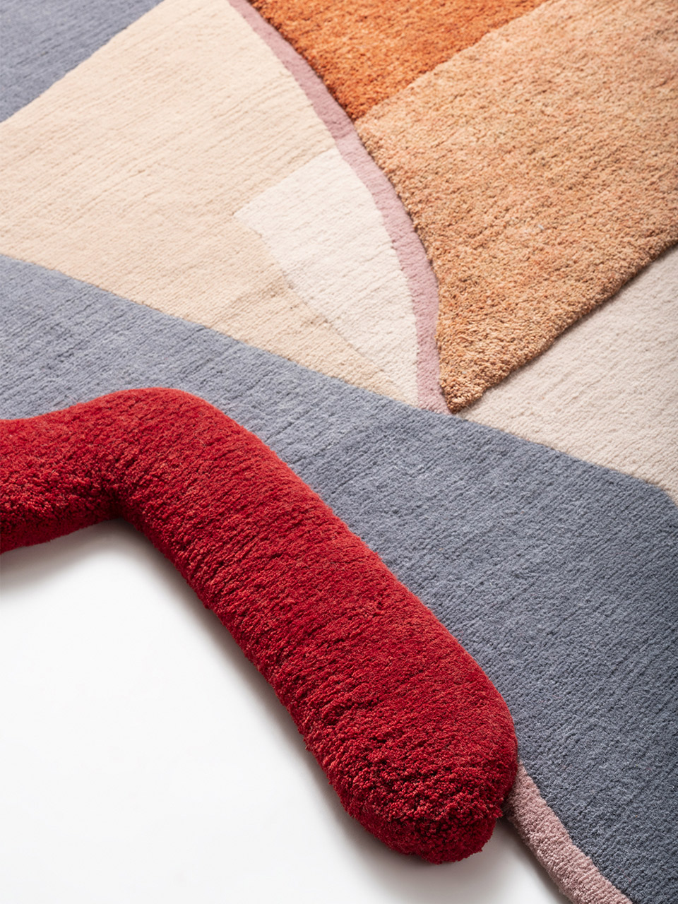
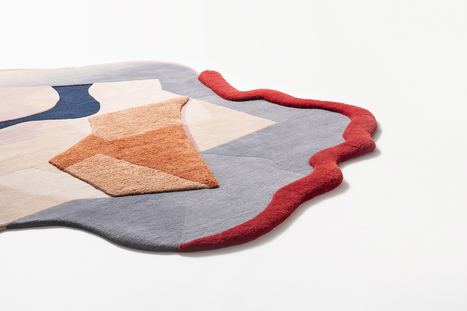
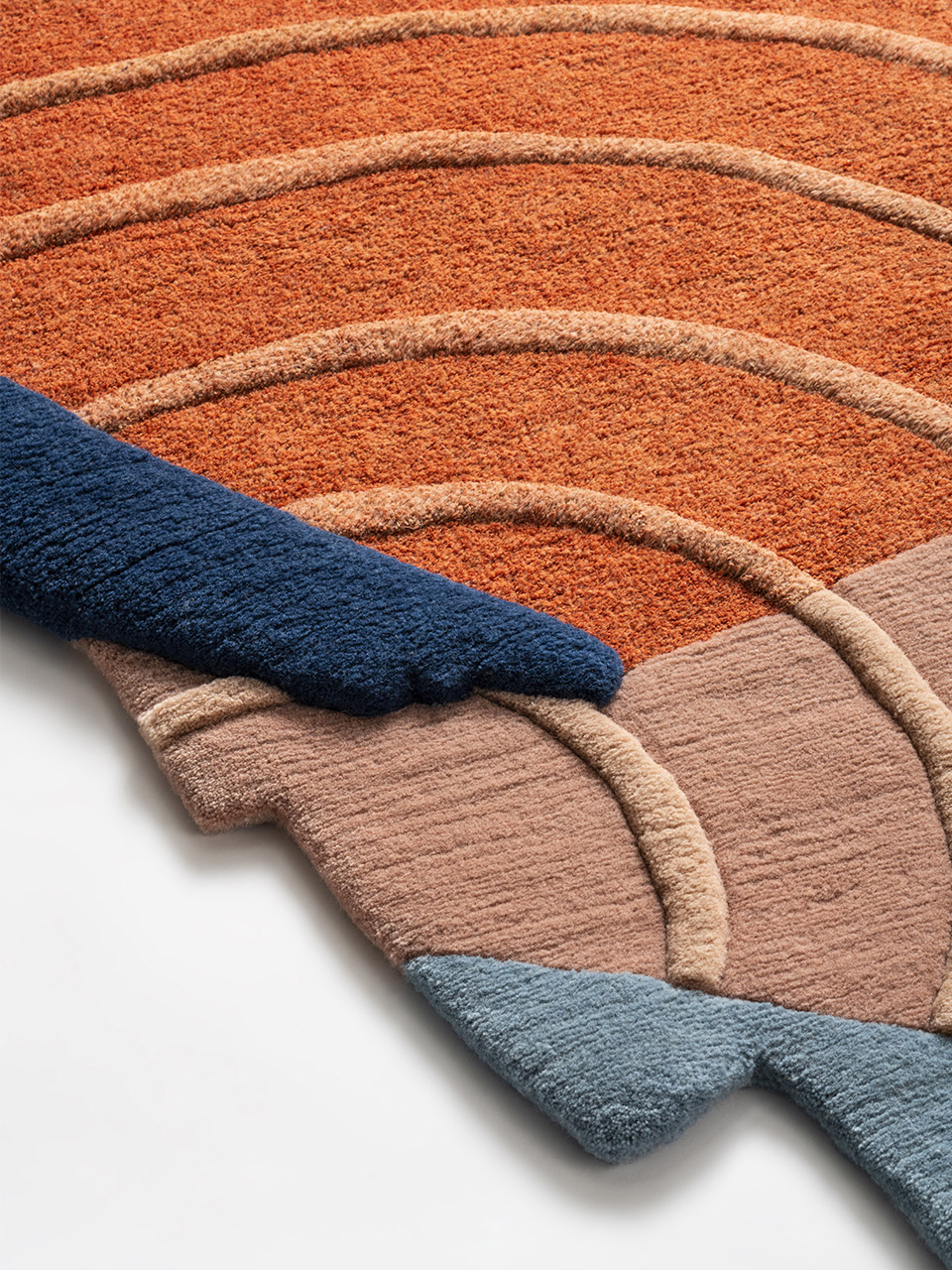
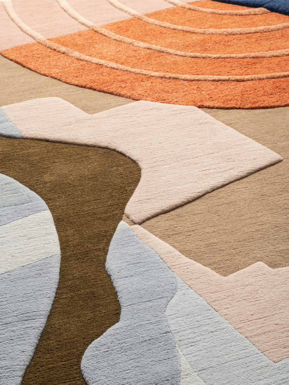
This action of deconstruction and reworking generates a new landscape - imaginary and therefore counterfeit - a textile papier collé, a collage of overlapping elements in which colors and shapes mix by stratifying, creating three-dimensional landscapes, impossible islands, cartographic visions.
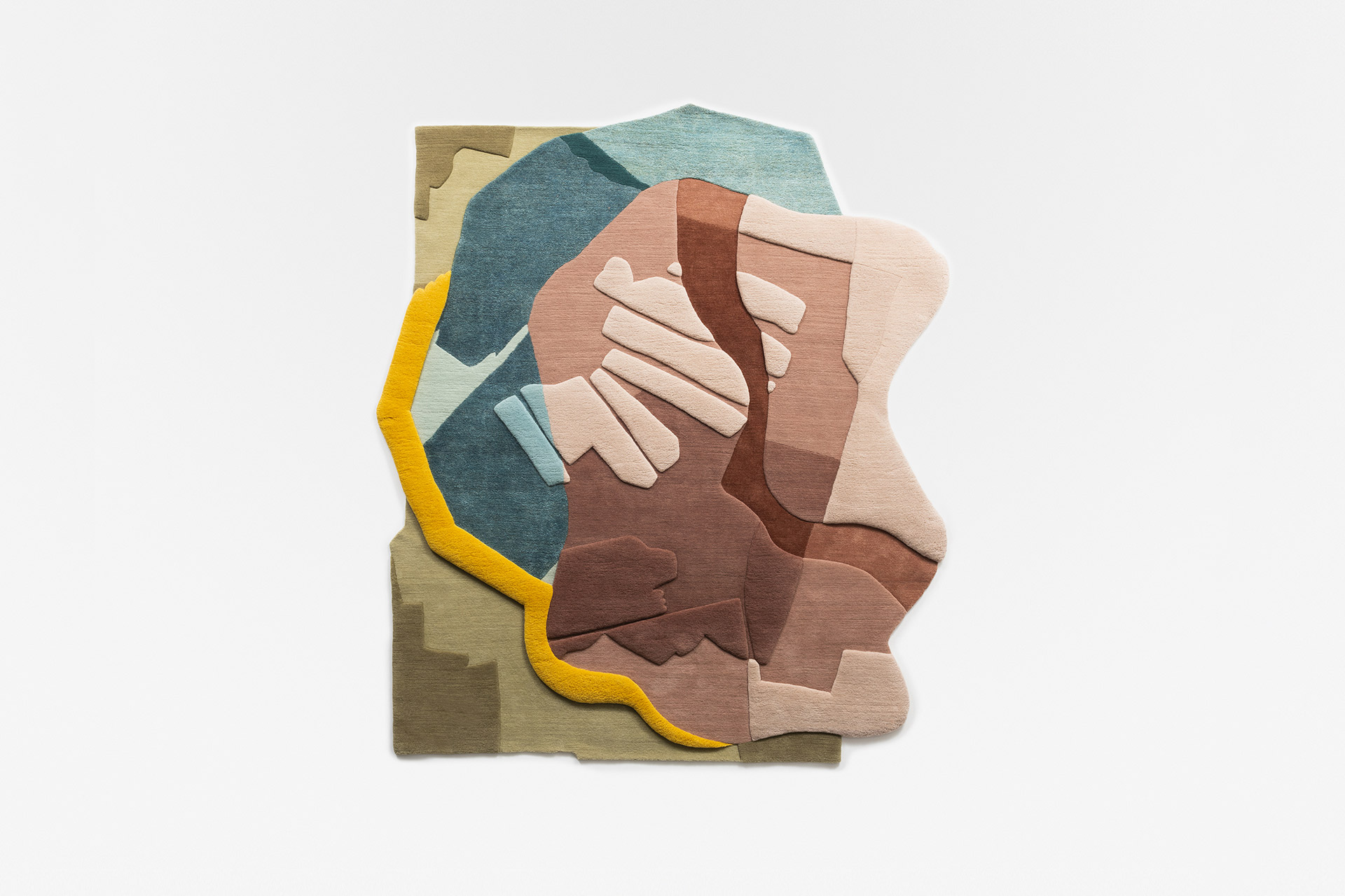
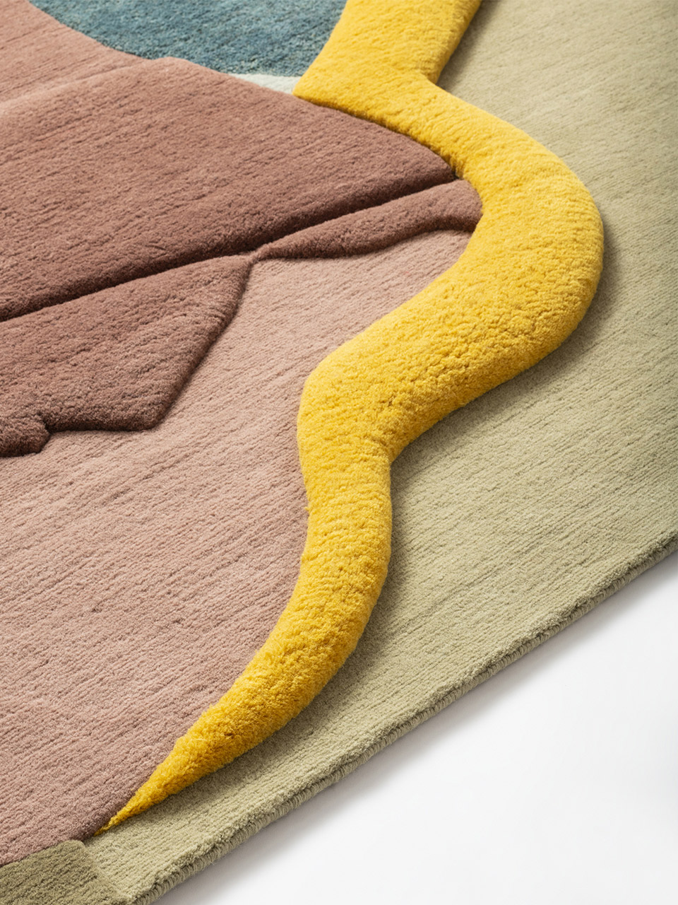
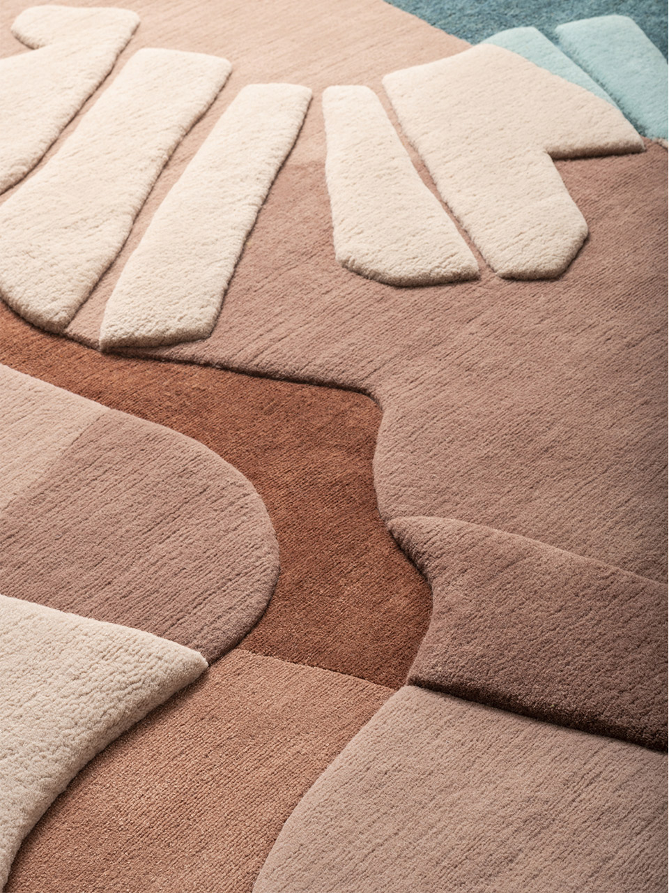
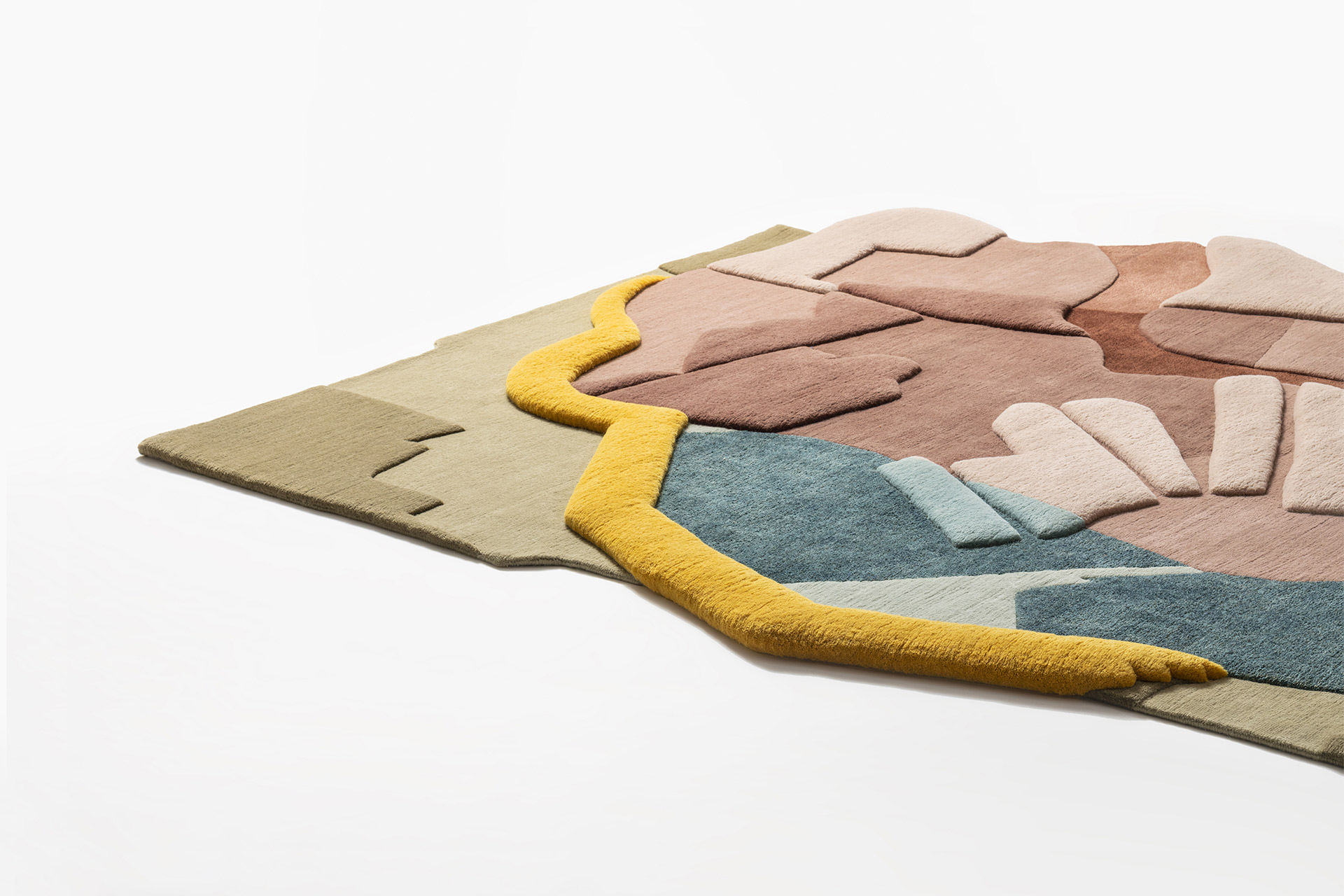
The carpets generated by this process are conceived as bas-reliefs,
constructed through the overlapping of colored fields made with materials such as wool, hemp and bamboo silk to create haptic surfaces.